Skip to content

T2S

Transformations to sustainability
  • About
    • Funders
  • Projects
  • Outputs
  • People
  • Events
  • News
    • T2S programme final meeting 2022
    • 2020 Midterm Workshop
  • Contact

One of the aims of the Transformations to Sustainability (T2S) programme is to build capacity for international research collaboration by supporting early-career scientists. For this long-read blog, journalist Riley Sparks interviewed early-career researchers from different T2S projects about the insights gained from carrying out transdisciplinary research as part of international project teams working in different settings worldwide.


Daiana Monteiro Tourne was trying to solve a mystery.

The ecologist and forest engineer wanted to understand what environmental factors help the endangered Brazil nut tree thrive, and what could threaten it. If scientists could understand those factors and build a map of suitable habitats for the tree, they could more effectively target their efforts to save it.

Tourne developed a complex model that allowed her to map Brazil nut habitats, feeding it a database of thousands of records of individual trees and tuning the model to take into account more than 100 environmental variables.

She’d answered part of the question – but the missing dimension was people, she says. To understand what threatened the trees and why, she needed to be on the ground, learning from communities and hearing what they know about their environment.

“I discovered that if I want to protect the forest, I need people. I need to understand how people manage and how people are involved with this natural resource,” Tourne says.

Now, as a doctor of applied ecology and researcher with the Transformations to Sustainability AGENTS project, Tourne brings that interdisciplinary approach to the project’s efforts to document innovative ways people in Brazil, Bolivia and Peru sustainably use the Amazon’s forests and waterways.

Around the world, researchers working with T2S are bringing local perspectives and context into sustainability conversations, combining multiple disciplines to examine problems through different lenses.

Tourne and the AGENTS team have documented local initiatives including farming co-ops, resource-sharing agreements and innovative agricultural techniques, as well as micro-industries like plant nurseries and medicinal oil production.

Using data gathered through fieldwork and geospatial analysis, AGENTS aims to inform policy by sharing community-based solutions that are already in use around the region.

“We’ve discovered a lot of strategies which people are doing with such few resources,” Tourne says. When it comes to research and policy, people in the region are often invisible, she says – but they’re the key to understanding how to support and amplify sustainability initiatives.

“I know this is important for science, combining both approaches – technologies as well as people’s opinions, traditions, history,” Tourne says.

In Busia, Uganda, researcher Esther van de Camp used her background in industrial ecology and anthropology to understand the complex dynamics at play in artisanal and small-scale gold mining.

Van de Camp, a PhD candidate at Leiden University who also trained as an industrial ecologist and anthropologist, contributed to the international Gold Matters project. The T2S project brings together a wide range of specialists including ecologists, artists, engineers and more, working in seven countries to explore how small-scale mining can become more sustainable.

Through fieldwork and conversations with miners, van de Camp’s research emphasized how local social, economic and environmental factors affect the choices miners make in terms of the tools and techniques they use, and therefore environmental impact.

Projects that aim to improve that impact and make sustainable changes need to consider broader social justice questions, not just the environment in isolation – it’s all connected: “Sustainability transformation includes structural transformation as well as societal transformation,” she says.

For Wilhelm Andrew Kiwango, part of that transformation includes looking at how colonial structures influence how we think about conservation, which is the focus of his sustainability research in Tanzania.

Kiwango’s work in southwestern Tanzania’s Ruaha-Rungwa ecosystem is part of the CON-VIVA project, which brings together teams studying the relationship between humans and apex predators on four continents: lions in Tanzania, wolves in Finland, jaguars in Brazil and bears in the U.S.

A post-doctoral researcher with a background in wildlife conservation and environmental governance, Kiwango is interested in looking at how people interact with animals.

“By training, I’m a wildlife manager and conservationist. That’s my passion. By putting social sciences into it, I came to realize the human dimension of conservation, and how that has been kind of neglected by conservation theory,” he says.

His research as part of the CON-VIVA project examines whether the colonial practice of “fortress conservation” – where wildlife is preserved through tightly controlled protected areas – is an effective method, and if it can be replaced with a new framework inspired by convivial conservation, which doesn’t separate the world so cleanly into human and wild spaces.

“People used to live with wildlife, from time immemorial, and there were no problems. These problems started when we started separating people from wildlife and saying, ‘This is for special people,’” Kiwango says. “We would like to see conservation done on our own terms, and in our own ways,” he says. Understanding how to rework the conservation model to fit the local context requires many different lenses, he says.

Doing fieldwork in the Amboseli region of southern Kenya, Kiwango heard from Maasai people about how they coexist with apex predators like lions and hyenas – even though some of their livestock are taken by predators every year.

“To them, that’s not an issue, because that’s how they’ve learned to live,” he says. But in his focus area in Tanzania, his research details a wide variety of communities with different practices and ways of living with predators, which raises a variety of questions about how a new conservation framework could be implemented.

The research also raises questions about governance: in Kiwango’s focus area in Tanzania, for example, the region has several different conservation strategies and different governance arrangements, rooted in an approach imposed by European powers.

The area includes a national park, as well as a game reserve that dates back to the German and British colonial governments. “In the national park, no shooting of an animal is allowed – but because there are no fences, when it goes to a game reserve, it can be hunted,” Kiwango explains.

“Implementing something like a convivial conservation approach in this area requires quite a lot of reconfiguration,” he says.

Kiwango says the current conservation model creates a walled garden guarded by heavy security that separates local people from the land, while leaving some areas open for wealthy tourists – mostly foreigners – to hunt.

It has led to an increase in protected areas, he says – “But we find it has also led to intensified militarization, what we call green militarization, where states will sponsor a war on poaching in order to defend charismatic species such as lions,” Kiwango says.

“The government depends very much on conservation and tourism for it to be able to do other projects, and therefore the government will do whatever possible to make sure conservation is done, especially in the mainstream conservation way that is separating people from nature,” he says.

Unraveling those questions requires looking at the issue from many angles. “Some of my colleagues are critical social scientists; some of them are political ecologists,” Kiwango says. “That contributed to enriching the methodologies, but also the results and output that we’ve had so far. Interdisciplinarity is very critical and it has been very helpful in ensuring that we achieve our objectives.”

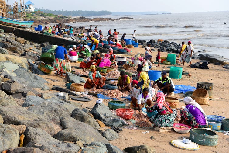
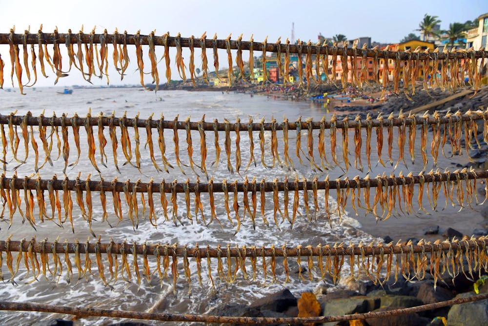
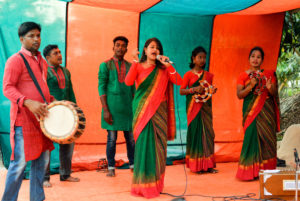
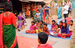
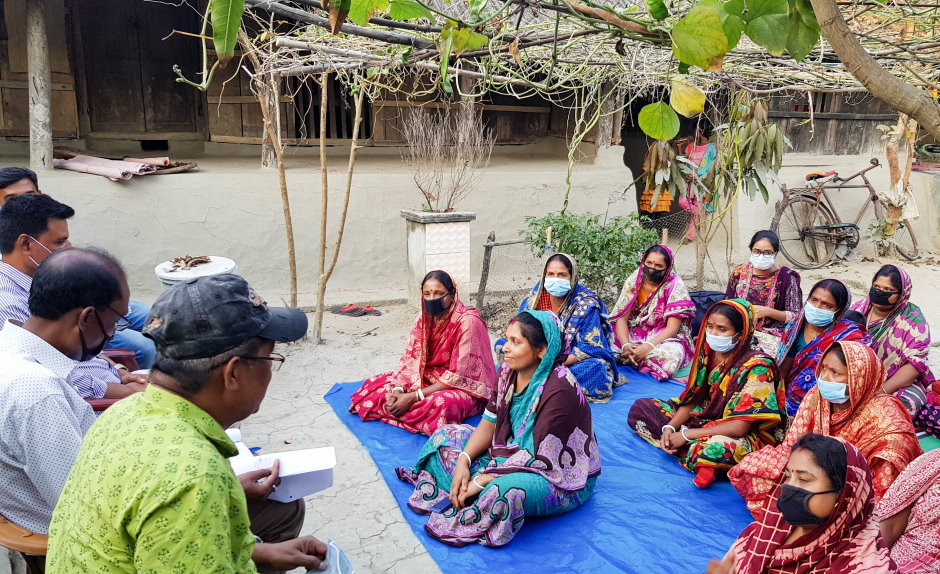
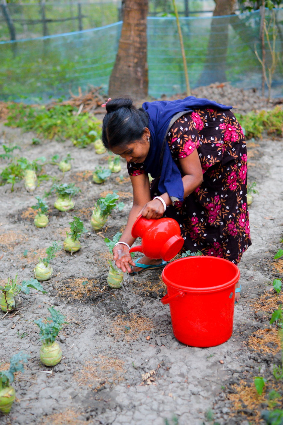
In Bangladesh and India, researchers with the TAPESTRY project wanted to understand how people in low-lying areas were responding to the imminent threat of climate change.

With the project focused on community-based initiatives, researchers decided to let communities guide the research priorities as well.

Every researcher brings their own lens to a project, says Shibaji Bose, a visual methods researcher with the TAPESTRY project. “I’ve got my own environment in which I’ve grown up, my thought process, the university I went to – am I a Northern Hemisphere researcher or a Southern Hemisphere researcher? – and so on,” he explains.

Researchers decided to put that aside and ask people in the focus communities to show them what they felt was important. “We want to know their worldview, their perception and their way of looking at things. It’s not important whether it’s right or wrong. There’s no right or wrong; it’s their lens,” Bose says.

The project built an enormous library of data through visual methods including the Photovoice method, where research participants use cameras to document moments in their lives, as well as photo diaries, paintings, work with archival images and more traditional social science methods.

“We set up this democratic space, where plurality of knowledge is something that we’re trying to do. So having different streams – the scientific knowledge, the indigenous knowledge – can come together and talk to each other,” Bose says.

He says he hopes the lessons learned from TAPESTRY and the T2S projects can inspire similar research: “If this plurality, and the plurality of lenses, using different lenses to look from different vantage points at the problem and the complexity – if that can actually be mainstreamed and more projects will be trying to use it, that in itself would be a huge achievement for T2S.”


This blog was developed during the final meeting of the Transformations to Sustainability programme, which took place in Paris, France, from 15 – 17 November 2022. It will be followed by a series of detailed perspectives from many of the early-career researchers attending the meeting – keep an eye on this site for more content coming soon.

The Koli community depend on fishing, but fish stocks off Mumbai’s coast have been declining. Akella Srinivas Ramalingaswami/Shutterstock.

By Lyla Mehta, Institute of Development Studies; D Parthasarathy, Indian Institute of Technology, Bombay; and Shibaji Bose, National Institute of Technology Durgapur.

Coastal cities and settlements are at the forefront of climate disruption. Rising sea levels, warmer seas and changes in rainfall patterns are together creating conditions that mean misery for coastal dwellers.

Disasters triggered by extreme weather often make headlines, but many problems linked to the climate are harder to see. These include the effects of warmer sea temperatures on marine ecosystems, the encroachment of seawater into once-fertile land, and coastal erosion.

Climate risks vary for coastal cities around the world. But according to the Intergovernmental Panel on Climate Change, people living in coastal settlements with high social inequality are particularly at risk. This includes cities with a high proportion of informal settlements and those built near river deltas.

The Koli people are one such community. As the original inhabitants of Mumbai, they are spread across a number of historic fishing villages on the city’s coast. But they have steadily been marginalised. Mumbai’s official development plan ignores the role of the Koli, and the ecosystems they depend on, in reducing the climate risks facing the city.

This has forced the community to take risk mitigation into their own hands. Through our work with the Koli community, we have seen how their response to human threats has the potential to create a city more resilient to environmental change.

Mumbai’s environmental problem

In Mumbai, enormous wealth co-exists with poverty. Largely built on reclaimed land, the city has undergone rapid development.

Poor waste management, property development and increasingly frequent extreme weather have reduced mangrove cover and polluted the city’s coastal waters. Mangroves are important breeding grounds for a diverse range of aquatic species. Many of these species, such as the Bombay Duck and Pomfret, are vital sources of income for Koli fishers and are key to mangrove biodiversity.

4 rows of bombay duck, a local fish, hanging to dry in front of a calm sea.
Bombay duck, a vital source of income for the Koli community, drying on a beach. Akella Srinivas Ramalingaswami/Shutterstock.

But fish stocks are disappearing fast. Environmental degradation combined with intensive trawling has led to declining catches for traditional fishers. This has affected livelihoods, with Koli women feeling the impact particularly strongly due to their prominent role in processing and selling fish.

Studies have also shown that mangrove forests protect coastal areas from storm surges and coastal erosion. Reduced mangrove cover means extreme weather events now inflict severe damage to fishing infrastructure. Cyclone Tauktae in 2021 inflicted losses of 10 billion rupees (£109,000) to coastal fishers – damage to fishing boats alone was worth 250,000 rupees (£2,700).

Taking the initiative

Following Cyclone Tauktae, the Koli produced reports documenting the changing frequency and intensity of cyclones affecting the region. These reports, supplemented by media coverage, have raised awareness of the community’s vulnerability towards climate change.

This has allowed the Koli to collaborate with various groups to reduce their vulnerability. We have been working with the Koli community through our own research project, Tapestry. Our research has involved creating photographs and maps with the community to build a more comprehensive understanding of the consequences of climate change and environmental degradation for the region. This has highlighted the importance of mangroves for marine biodiversity and flooding protection.

An aerial shot of a mangrove forest in the foreground of a large sprawling city.
Mumbai’s mangrove forests are crucial for marine biodiversity and flood prevention. Viren Desai/Shutterstock.

The efforts of the Conservation Action Trust, a Mumbai-based non-profit organisation that aims to protect forests and wildlife, have also been key in protecting mangroves. They found that mangroves were being cleared to make way for golf courses, residential buildings, rubbish dumps and transport infrastructure. They were instrumental in the development of the Mangrove Cell, a government agency that monitors efforts to conserve and enhance mangrove cover in India’s western Maharashtra state.

Addressing water pollution also emerged as a priority through discussions with the Koli community. Our project partner Bombay61 has since implemented measures to improve water quality. Over three days, a pilot trial of net filters collected around 500kg of waste from a single creek. This initiative also challenges the perception of creeks as “drains” or “sewers”.

A cluster of plastic bottles and litter floating in brown water.
The coastal waters the Koli depend on are heavily polluted. TK Kurikawa/Shutterstock.

Engagement between the Koli community, environmental organisations, government officials and local public events and exhibitions has allowed more equitable solutions to human threats to be explored. These highlight the importance of local communities to resource governance and urban planning, and could help dissuade the government from destructive future development plans.

The lessons from the Koli experience extend beyond just Mumbai. While each coast and city will face different threats, the seeds of responses can be found in the people who know and understand the environments in which they live. Working with grassroots methods and groups can reveal how action can respond to local needs and address more than just physical climate risks.

If local strategies can be scaled up, they could transform urban planning and climate change mitigation. These strategies must address the need to adapt to climate change and minimise human disturbance. Paying attention to local people’s struggles and harnessing their ideas can be an essential part of creating cities that are more resilient to future threats.The Conversation


This article is republished from The Conversation under a Creative Commons license. Read the original article.

This blog was originally posted on the TAPESTRY website on 8 August 2022. 

An innovative fishing net installation has collected around 500 kg of waste from a single outlet in Malad creek in three days.

Bombay61 Studio (B61) and TAPESTRY co-created this solution in synergy with the Koli community, which has traditionally served as the first line of defence for the coastal ecosystem of the city.

A new report explains the process of designing the net filter system, and a video shows how it was installed.

Koli communities and pollution in Mumbai

The indigenous coastal communities have been the caretakers of Mumbai’s rich biodiversity and coastline for centuries. Yet their voices are sidelined when it comes to the city’s livability concerns.

This marginalization is evident in the constantly deteriorating condition of the city’s rivers and creeks, which are critical sources of subsistence and livelihood for these communities. The degradation of the city’s water channels is normalized in the official references and everyday associations of the creeks with ‘nallah’ (drains).

The Mumbai Climate Action Plan, announced on 13 March 2022, recognizes the disproportionate impact of climate change induced hazards on the vulnerable communities like the Kolis and talks about increasing the resilience of these communities.

This action plan needs to be made more inclusive by acknowledging the direct impact on the sustenance and the livelihood of Koli community and other creek dependent communities due to polluting creeks, and the solutions they have to offer to address the city’s livability concerns.

The problem has reached such a magnitude that Kolis now catch more plastic in the nets than fish! However, this very scenario, along with traditional fishing crafts and techniques, was leveraged to ideate and pilot test an innovative installation to trap the solid waste in Versova creek.

How the filters were installed

The net filters were designed to ensure the uninterrupted movement of fish, while creating an efficient method for waste collection.

The installation imitates a traditional fish catching system, that of Dol nets, which can be anchored along the mouth of creek outlets at strategic locations to maximize garbage removal.

In the video, you can see the meticulous process through which the net filters were installed by the Koli fishermen. The filters, which extracted 500 kg of waste from the creek in 3 days, could be replicated and scaled-up for other creeks in Mumbai.


This solution, while leveraging the situated traditional knowledge of the Koli community, also provides room for collaborative ecosystem building by involving multiple stakeholders – from waste experts and agencies at the segregation and recycling level, to civic authorities, other nodal agencies and young Mumbaikars – to push for the wider adoption of this model.

Read the report

A detailed report by Bombay61 Studio and Tapestry, with the support of a Mumbai-based partner, Ministry of Mumbai’s Magic, explains the participatory process through which this community-led and innovative solution was evolved. As the report explores, this simple solution has a great potential for transformation ‘from below’.

The report also shares several recommendations, including:

  • the introduction of the goal of a clean and healthy creek as an agenda for the civic authorities,
  • recognition of the role of indigenous community and re-classification of nallahs as creeks,
  • scaling-up and proper implementation of the Net Filters Installation through multi-stakeholder collaboration, and
  • stringent laws for sewage disposal.

Find out more and download the report from the TAPESTRY website.

By Miguel Angel Trejo-Rangel, Victor Marchezini, Daniel Messias dos Santos, Marina Gabos Medeiros and José Carlos Luzia Rodrigues. This blog was first posted on PreventionWeb on 24 May 2022.

Why social innovations to enhance disaster risk reduction?

Between 2000 and 2018, Brazil was hit by 65 flood-related disasters, representing close to 71% of disasters recorded. They were also the deadliest – causing 2,435 fatalities out of a total of 2,767.

It is therefore necessary to examine how societies respond to hazards using social innovations. Social innovations, according to Geoff Mulgan (2006), include actions that are related to the creation of long-lasting innovative activities, and services that are motivated by a social need.

This project looks at how social innovations could enhance disaster risk reduction (DRR) – and which innovations would be best suited to achieving results – in São Luiz do Paraitinga, Brazil, a city that is frequently exposed to floods and landslides.

Location of São Luiz do Paraitinga, São Paulo, Brazil (Trejo-Rangel, M. A., 2022©)
Location of São Luiz do Paraitinga, São Paulo, Brazil (©Trejo-Rangel, M. A., 2022)

What did we do?

We conducted a number of activities to look at which social innovations could enhance DRR in São Luiz do Paraitinga, and how they could be applied. Local high school teachers and civil defense members were enlisted to the core group to organize activities, and other participants (including the general public, high school teachers, and students) contributed by sharing their insights.

A participatory 3D model

The first activities were facilitated by the implementation of a low-cost participatory 3D model (P3DM) –a communicative facilitation method that can be used to stimulate participation in characterizing hazards, vulnerabilities, capacities, and disasters.

The P3DM was used in the town’s main square and the only high school, with different focus groups (general public, high school employees and students) and using a range of methods (semi-structured interviews, roundtable conversations, discussions, and presentations) to understand what social innovations could be led by locals to enhance DRR, and how.

The participatory 3D model, s made of low-cost materials, was used to represent the territory and its elements for the intervention (©Miguel Angel Trejo-Rangel, 2019).

Participatory mapping

The second activity was participatory mapping – a method that requires accessible geographical information, and the participation of specialists to communicate data to high school students.

The participatory 3D model, s made of low-cost materials, was used to represent the territory and its elements for the intervention (©Miguel Angel Trejo-Rangel, 2019).

The participatory mapping activity was facilitated with high school students at a workshop during which the participants were asked to identify hazard-prone areas and social groups with higher vulnerability, and then to propose DRR measures.

Survey

After collecting the social innovations that could be implemented for the city, we shared a survey of 26 questions. The survey was useful for gathering data about which actions interest responders most, to know what partnerships could be developed and what resources would be needed to implement the actions.

Online survey to identify social innovations (Miguel Angel Trejo-Rangel, 2021©).
Online survey to identify social innovations (©Miguel Angel Trejo-Rangel, 2021).

Seminar

Lastly, we organized a two-day hybrid seminar, at which both in-person and online participants engaged in roundtable conversations, a music presentation, a photography exhibition, and pedagogical games, as well as presenting the main outcomes of previous activities.

Roundtable with key stakeholders (©Victor Marchezini, 2021).

What did we find?

The project gave high school employees, students, and the general public an opportunity to identify social innovations to enhance DRR in their city. The ten actions selected by vote were:

  • prevention plans
  • natural area conservation and restoration
  • tours of at-risk areas
  • engagement of children and youth
  • evacuation plans
  • mapping of vulnerable areas
  • community monitoring of the Paraitinga river
  • communication mitigation measures
  • territorial and land-use planning
  • community-led rainfall monitoring.

These measures should be implemented by the community, with support from the relevant critical sectors (such as government, NGOs, and the private sector). The plan also requires technical, financial, and human resources, as well as incentives to motivate community members during the implementation processes.

Finally, the project noted that public policies should support the implementation of social innovations to promote disaster risk reduction, but these policies should also be developed using a social-innovation approach.

The most voted measures selected by respondents (Miguel Angel Trejo-Rangel, 2022©).
The most voted measures selected by respondents (©Miguel Angel Trejo-Rangel, 2022).

What happens next?

As a group, we recognize that DRR is a continuous process that should include a wide range of stakeholders. We therefore encourage other DRR facilitators and locals to see this project as a replicable practice that can be adapted to other contexts, in other areas exposed to the impact of other hazards. But most importantly, it is an intervention that includes the groups directly impacted by disasters.

As we move forward, we need to make sure that the proposals are implemented and supported by the stakeholders who can provide resources and incentives to make these actions possible.


Miguel Angel Trejo-Rangel is a doctor in Earth System Science by the National Institute for Space Research, researcher at the Disaster Research Group (GPD) and specialist in Disaster Risk Reduction.

Victor Marchezini is a Sociologist of Disasters, researcher at the National Early Warning and Monitoring Centre of Natural Disasters in Brazil, professor of the Earth System Science postgraduate program at the National Institute for Space Research, and coordinator of the Disaster Research Group (GPD).

Daniel Messias dos Santos is a historian and pedagogue with a master’s degree in human development, and is currently a high school teacher at the State School Monshenhor Ignácio Gióia in São Luiz do Paraitinga.

Marina Gabos Medeiros is a historian, and is currently a high school teacher at the State School Monshenhor Ignácio Gióia in São Luiz do Paraitinga.

José Carlos Luiz Rodrigues is the head of the Civil Defense in São Luiz do Paraitinga, São Paulo, Brazil.


After two years of virtual co-working, Gold Matters project members reunited for an end of project workshop held in mid-May at the Nordic African Institute in Uppsala, Sweden. At the workshop they explored their learning from the project and refined its key conclusions. This post was first shared by Luciana Massaro on the Gold Matters website.

The Gold Matters Write Shop 2022

Finally, we met again! The Gold Matters members reunited after two years of virtual co-working on the occasion of the project workshop held in mid-May at the Nordic African Institute in Uppsala, Sweden. Emotions, ideas, and conversations flowed from the first moments and renewed our energy and enthusiasm for our project.

To break the ice, each member was asked to describe their journey in the project by bringing a meaningful object: a retort, two pieces of art, a pack of beans, a pen, two erasers, a book, a magnifying lens, a map, a notebook, a pair of shoes, a gold nugget, and a scale for weighing gold. Some objects represented the researcher’s personal involvement in the field, others spoke of miners’ everyday working life – these objects became useful tools for reflecting on transformations to sustainability.

In mid 2020, when the pandemic outbreak took a toll on our taken for granted lives, it became essential to switch to remote working in order to carry on with the research project. The pandemic exposed how vulnerable our jobs are, but also revealed our privileges with respect to many sectors with less flexible working conditions. We became used to seeing each other through a screen frame, often in the more intimate settings of our houses. It became normal to have funny interferences from family members and pets, and luckily, we never had any awkward moments.

As engaged anthropologists, we all started reflecting on meanings and consequences of such change on our personal and working life. It was striking how irreplaceable face-to-face interactions have proved to be. How nice it was to work together again in Uppsala, and also to share a laugh in person, especially if we consider that some members that joined the project more recently, like myself, never had a chance to meet the others face-to-face. It wasn’t only the impossibility of doing fieldwork for more than two years, but also the opportunity of visiting other fellow academics in their institutions, and exchanging knowledge and experiences.

The workshop, brilliantly organized by Eleanor Fisher and Cristiano Lanzano, went on smoothly, between working sessions, coffee breaks and nice dinners around Uppsala. All participants and personnel from the Nordic Africa Institute got involved in a live painting performance with artist Christophe Sawadogo, where we were invited to use the paint to write down and draw ideas and feelings over the importance of knowledge and education.

The workshop ended with a visit to the old Sala Silver mine, where we had the chance to physically descend into an example of Swedish industrial historical heritage that was also once a small-scale mine. What a perfect way to conclude our workshop!


Luciana Massaro is a post-doc from the Vrije Universiteit Amsterdam (NL)

In this blog, Esther van de Camp shares insights from a scenario planning workshop at which gold miners debated the most important and uncertain drivers of ASGM in relation to sustainability, and envisioned four worlds and one priority.

Four worlds for 2042
This painting visualizes four worlds that small-scale gold miners in Busia District, Uganda, have envisioned for 2042. The worlds cover the extremes of the most important and most uncertain drivers of ASGM and sustainability: land ownership and empowerment of ASM. Artist: Achom Agatha.

As part of a last PhD fieldwork, in 2022, I collaborated with fourteen leaders of several Artisanal and Small-scale Mining Organizations (ASMOs) in Busia District to do a Scenario Planning workshop. This Scenario Planning was a transdisciplinary method that used both artistic and scientific principles to i) pinpoint two paramount uncertainties of Busia’s gold mining future, ii) envision four worlds that cover the extremes of those uncertainties, and iii) prioritize strategies accordingly (Masterclass 2015). This was the driving question of our workshop: “considering the coming 20 years, how can we continue to develop a sustainable gold mining business?”

The workshop took place at the new school located on the edge of the village trading center, where the noises of ball mills and other mining machines were out of ear’s reach. The lawn surrounding the school showed traces of the exploration for gold that was put on hold in support of building the school. Tranquility and spatiality market the atmosphere of the school terrain. At the end of the day’s workshop, the terrain’s calm atmosphere felt like a silence before the storm.

The main take-home message of the workshop was the threat that miners increasingly felt that they would lose their land. A miner explained: “a big storm is coming, because little do we know that we are sitting on the richest gold belt of East Africa and nothing can stop them from evicting us.” This threat and awareness impacted the way that miners negotiated their various strategies for sustainable futures.

The small-scale mining professionals identified – in relation to their gold mining future and its transformations to sustainability – two paramount uncertainties, four worlds, and one strategy. The two uncertainties were land tenure (indefinite land ownership or loss of land)[1] and empowerment of artisanal and small-scale mining (high or low). Other important drivers were education, attitude, technology and investments. Along the axes of the two uncertainties, they envisioned four worlds: ‘Out of our hands’ (land loss – high empowerment), ‘Gold in our hands’ (land owned – high empowerment), ‘Misery world’ (land loss – low empowerment) and ‘Promising world’ (land owned – low empowerment). Miners concluded that a fundamental strategy should be to survey the land: certainty of land ownership enabled and strengthened investments in other measures that miners are engaged in, such as underground mining, substitution of mercury and land reclamation.


[1] This corresponds to the land tenure systems freehold and leasehold out of the four types of land tenure in Uganda.


Esther van de Camp is a Ph.D. student from Leiden University (NL)


Workshop team:

ASMO representatives: Aguttu Josephine, Amoding Beatrice, Angesu Paul, Apio Everlyn, Engidoh Paade, Kataike Margaret, Wabwire Simon, Masinde Betty, Naume Sarah, Olaro Augustine, Omoit Eriya, Omukaga Alex, Ujaala Robert and Samanya Isaac.

Host: Ongurata Richardson, headmaster of Tiira Golden Primary School in Tiira Town Council

Artist: Achom Agatha from Busia District, Uganda

Facilitators: Marauni Shadrack, youth representative in Busia District & Esther van de Camp, Leiden University

Masterclass (2015) Mastering the Future with Scenarios: Report of 3-day Masterclass with Ulrich Golüke September 11-12-13, 2015 Scenario Planning Masterclass.

Nii Obodai in conversation with Eleanor Fisher.


One day we will have left images and information that will allow people in the future to see where we are today and why they are who they are, in whatever future we have created for them. So, the photograph becomes part of cultural history in the making.

Nii Obodai works with photography, audio and text, and has a particular interest in recording and celebrating the unseen and every day in Africa. Working in black and white, his photography encompasses portraiture and ethereal landscapes. In conversation with Eleanor Fisher at the Nordic Africa Institute, he reflects on how he was drawn to portray the lives of gold miners for his series “Big Dreams, Life Built on Gold”, which is featured in an on-line exhibition: https://www.exhibitiongoldmatters.com/

©Nii Obodai
©Nii Obodai

EF: I know from having watched you take photos in Ghana that you have a certain way of working, can I start by asking you to describe your approach?

NiiO: My approach has been the same for the last 25 years – I am still shooting film. I enjoy the aesthetics and the process; I enjoy experimenting with film material and the chemicals, and with different printing materials. It is important that each story has its own feel, in terms of discovering an aesthetic that becomes unique to that body of work. That is where the experimentation comes in; I find working with film very satisfying.

I started with small format photography cameras and film, now most of the work I shoot is with large format film cameras. This is a more slower and engaging experience, it is more gratifying in terms of getting the kind of information that I want, especially out of landscapes, and portraiture. I get a lot more detail in large format film.

Gbane, Northern Ghana
©Nii Obodai

EF: I know you prefer to use black and white for the images you produce, is there a reason for this?

NiiO: Well it’s just a matter of practicality, the chemical formulas I either make myself or I can find them in my area or import them. Most of the film I have to import, but also I can use household products to make the processing chemicals and the fixers. Colour photography, it is always incredibly complicated maintaining the temperatures, like where I am here today in northern Ghana; it is incredibly hot and dry. I would need a ton of ice to develop film here. I have a lot more control with black and white processes and anyway I simply enjoy making photographs in black and white.

©Nii Obodai
©Nii Obodai

EF: For your series Big Dreams: Life Built on Gold. Can you explain a little about the motivation?

NiiO: If we go back to 2013 or 2014, I started hearing about Chinese miners in Ghana, illegal migrants coming in and acquiring concessions and digging up forest regions and basically taking over the galamsey [small-scale] mining industry. Conflict started taking place between the Chinese and local miners, I wanted to understand what was going on. There were lots of reports [in the Ghanaian media] concerning the environmental impact, the negative impact it was having on the forest and on communities, A few years before, I made a commitment to myself that I would focus the majority of my work on the environment. This story of the miners and their relationship with the environment, I really felt I had no choice. It was compelling, I had to see for myself what was happening.

At first, I thought it was all about the Chinese, because a lot of the information I was getting was coming from the radio stations and it was very graphic, about the Chinese being in conflict with local people and the devastation they caused, so there was a lot of blame on them. Then I started asking myself questions, ‘well how did they get there’ they can’t get access to land unless a Ghanaian gives them the access to the land. It’s not possible for anybody to come into Ghana and just appropriate land, it doesn’t work like that, our traditional and governing systems don’t allow for that to happen because the ownership of the land is with the people. That meant that we have to ask ourselves the question of why this is taking place?

One of the fundamental ways I approach photography is from the point of view of offering whomever I am working with – whoever gives me access into their lives – dignity, and this plays a major part in our relationship building. So even with the Chinese it was not pointing blame at them or shooting them in ways that put them in compromising positions with my photography, but rather see them in a non-judgemental way, so it was really about getting to know why they had come here and what all of this means.

©Nii Obodai
©Nii Obodai

Photography is such a powerful medium to work with. Making photographs of people is a privilege, it is not something that I take as a weapon to degrade people through images. This is especially true as I come from a culture where through our history – if you look at the early history of photography in Africa – the camera was used to dehumanise people, it was used as a way to further policies and motivations for exploitation of Africa. So, photography has a history in Africa that sometimes makes us uncomfortable and we (photographers) need to be aware of that and especially those of us coming from here ourselves. When we are working, I think it is very important that we use photography in ways that actually benefit everybody and not just the image-maker or for other nefarious reasons let’s say.

So yeah, with the Chinese it was on the basis that we would engage as people meeting each other and listening to each other’s stories. As those relationships grew, it also allowed me time to start making relationships with Ghanaian miners who were taking over Chinese fields because the Chinese were being deported from the country. I started learning more about our cultural attitudes towards the galamsey. You know gold mining has been going on in this region for centuries; it is nothing new so it is important to understand the history of gold mining here, through traditional storytelling, even from spiritual aspects of gold mining. This really means getting to know people, getting to know their communities, the hierarchical systems in communities, and not just going in as a photographer and bang, bang, bang with lots of images, they look great, but…

Gbane, Northern Ghana
©Nii Obodai

EF: That raises an interesting question because from working in artisanal gold mining communities myself I know how much distrust there can be to outsiders. You have some very intimate portraits and I was wondering how do you build that rapport?

NiiO: Hmm – its time. Time and lots of visits. When I first approach people, they think I am working for the press or working for the government and I am not working for either so I let them know that I am coming to them more as an artist / documentary photographer. These investigations are part of my artistic practice, and the work is not there to be in any way, let us say, profit-making through the media, in terms of exposing who they are. For me the work is more than trying to explain to people today, it is actually for the generations that are not yet born, that one day we would have left images and information that would allow them to see where we are today and why, and why they are who they are in the future. It’s more about seeing the photograph as part of our cultural history in the making.

©Nii Obodai
©Nii Obodai

EF: I love that reflection about photography and its value for people who are not yet born, which brings me to the theme of sustainability and future generations and I think my final question. You are working with us [the Gold Matters project] within a transdisciplinary team, which brings all sorts of researchers together, what is your observation about what photography brings to our work and to the Team?

NiiO: When we look at our collection of works there is some really brilliant image-making that has been done,  especially because with the researchers you can see they are invested in their research and the people they work with. For me, you asked me the question of how do I build trust? Well, one of the things I read in most of the images, indeed pretty much for everybody in the research team is that they have worked on building trust, coming back and building upon the relationships in the locations that they are working. This has allowed us to make images beyond just the factual, that you can actually read through the photography that some good connections have been taking place in the research field, it is not just us researching them, but it is collaborative. I mean we’ve got our miners shooting film and making videos of their lives as part of the project, it’s a very intimate process that we bring into this research, its not cold.

EF: I think that is a nice note to end on, around the fact that it is a collaborative process, we could go on talking but let us leave it there for today, thank you very much Nii and I hope your trip continues to go well.

By Sumaiya Binte Anwar, Research Officer, ICCCAD; Mahmuda Akter, Research Officer, ICCCAD; Faizah Jaheen Ahmed, Research Intern, ICCCAD

“We are the people of coastal area, Our sufferings know no bounds, We have to survive fighting various disasters.”

—Shagorika Mondol, song sung to pattachitra scroll on disaster awareness

How do you creatively inform the community about dealing with a tragedy that regularly befalls them? Or encourage them to stand back on their feet after a natural calamity strikes?

A troupe of performance artists from the small town of Shyamnagar, Satkhira, do this through a unique folk tradition of visual storytelling using a pattachitra (traditional scroll). The story depicts their tale of sufferings through colourful performances. The songs have catchy choruses, which once heard, are difficult to shake from one’s mind.

Our two-person team visited the town as a field visit as part of the TAPESTRY project in March 2021. We were happy to discover that the local cultural group ‘Jubo Shilpigoshthi’ in Shyamnagar had created scrolls that raised awareness of the impacts of climate change and natural disasters – very frequent visitors to this region. The artists were printing and singing about current events, as well as mythological subjects. Some of their scrolls commemorated the tragedies of natural disasters such as cyclones Aila and Amphan, while others promoted social issues, health education, and preventive measures against lack of sanitation or the coronavirus pandemic.


The long patas (scrolls) visually tell the story of preparing for disaster, in the form of paintings or printed pictures. An additional attraction is the rhythmic lyrics of an accompanying song. The choir composes a ‘pater gaan’ (narrative song) to go along with the printed scrolls. The team dances to the rhythm and beats of local instruments as they narrate the stories of the patas, following the style of narrating ballads. Shagorika, the lead singer of the team, told us that it took her about 15-20 days to write the lyrics, compose the song and print the scroll with relevant pictures.

Printed Scrolls on Tropical Cyclone Preparedness. By: Sumaiya Binte Anwar

Her Pattachitra performance described the frequency of climate-influenced disasters in this southern coastal region, and their effects on local people. The performance highlighted how human activities like the deforestation of the Sundarbans have contributed to the rise in global temperatures, and influenced disasters such as floods, droughts, river erosion and tidal waves which occur every year, destroying their lives and livelihoods. Through the song, they answered questions on how to react, what to do and how to remain protected against damage if they are faced with a devastating tropical cyclone.

During the show, the Patuas (painters) gradually unfurled the long scrolls as the song continued:

“Be aware of the danger signals 9 and 10 You should stay safely together inside the shelters.”

Local people are trained on preparing for cyclones, and this training includes information on what the warning signals mean. But many people find this complicated, or they forget the meanings of the signals as time passes. When the same message comes through a melody of a song, accompanied by scrolls with pictures, the signals becomes easier for them to remember. Such activities have helped convince children and adults of the importance of evacuating to shelters – this is what a million people had to do as cyclone Aila and Amphan made their final approach.

Shagorika and her Pattachitra Team By: Sumaiya Binte Anwar

The lyrics also portrayed the sufferings of the coastal people, particularly the people of the Sundarbans, who rely on the mangrove forests, and make their living from agriculture, collecting honey or fishing activities. The song narrated how the traditional livelihood sources of the people have recently been at risk from frequent disasters. This aligns with the purpose of the TAPESTRY project, which is to understand the transformations in livelihood opportunities of coastal people, and how they can adapt to new changing environments or become more resilient to disasters.

Art historians have suggested that the traditional artform of pattachitra has been practised for over a thousand years in rural Bangladesh and some parts of India. Historically, pats were cloth scrolls on which mythological or historical and religious epic events and stories were painted as a sequence of frames. Pattachitras have been compared to cinema frames or animation, and are said to be one of the oldest forms of audio-visual communication.

More recently, pattachitra artists have broadened the tradition to include contemporary local and global events. They have begun telling stories from diverse social issues, like dowry and family planning, and issues related to health, as well as using the scrolls as an educational tool for advocating birth control, and awareness of the spread of HIV. In recent times, narrative pictures are printed in sheets instead of paintings.

Shagorika and her team usually perform during winter on the premises and courtyard of the house of a rich person or a leader of a village. Tents are set up, and an audience gathers and sits on mats on the ground as the performance goes on. Normally, the team would travel from one village to another to present their stories, but the pandemic has grounded them to their local area.

Village audiences gathered in the courtyard to watch the Pattachitra Performance. By Sumaiya Binte Anwar

Meanwhile, the government and various NGOs have been working to raise awareness among the local people of these areas, through awareness training, Utthan-boithok (backyard meetings), posters, seminars, plays, songs and so on. Traditional mediums like pattachitra performances, with bright visuals and strong lyrical messages, serve the dual purpose of capturing people’s attention through entertainment and educating them on crucial issues.

Going forward, reviving thematic pattachitra performances could be an effective way to inform coastal people about transformative livelihood options and alternate livelihoods, while preserving the culture and traditions of the Sundarbans for years to come. It could also help to preserve a traditional art form with a thousand-year-old history, which is otherwise in danger of dying out.

By Flurina Schneider, Theresa Tribaldos and Stefanie Burkhart. 

Addressing complex sustainability problems requires more than scientific knowledge. Researchers must collaborate with societal actors from government, business and civil society, and engage in the co-production of knowledge and action. Sustainability-oriented networks can help to foster this co-production as they link different types of actors across various scales. But how can such networks effectively facilitate co-production? The ‘network compass’ offers guidance in supporting networks to reflect on effective strategies for sustainability transformations.

Network compass
The network compass, by Flurina Schneider

Why do we need knowledge co-production?

Co-producing knowledge and action means that various actors jointly generate context-specific knowledge and pathways to sustainable futures. It is an alternative model to more classical forms of science-society interaction, where science is assumed to generate new knowledge that society then acts on. Since sustainability problems are often too complex and contested for individual disciplines to generate solutions on their own, the co-production of knowledge and action is a promising way forward as it makes it possible to combine diverse types of knowledge from both, different disciplines and practice.

What are sustainability-oriented research networks and why do they matter?

Sustainability-oriented research networks such as Future Earth are formations linking actors from science, policy and society across geographical scales or sectors in order to promote collaboration in producing knowledge and/or action for sustainability. Such networks are usually organized around a kind of ‘support entity’ (e.g. a secretariat or steering committee) helping the network members to achieve their jointly defined mission. This mission, but also a network’s governance philosophy and related activities differ between networks. Some networks focus on research, while others are more interested in turning knowledge into action. Despite their diverse missions, philosophies and structures, networks share certain functions and capacities that differ from those of individual organizations, such as universities or research projects. In the case of knowledge co-production, networks are particularly useful in their functions of, for example, flexibly connecting different actors, joining forces or disseminating information.

How the ’network compass’ can support networks

The network compass represents an important starting point for structuring a process of systematic reflection on how networks can contribute in various ways to co-production and sustainability transformations. The methodology was developed through a reflection and learning process undertaken with different partner networks of Future Earth such as GLP, GMBA, BioDiscovery, MRI, PAGES and ITD Alliance to better understand how global research networks can be more effective and collaborative in contributing to sustainable development.

Network compass
Figure 1: ‘The network compass’: four generic fields of action, each with five subfields, through which networks seek to foster co-production of knowledge for sustainability transformations (Schneider et al. 2021).

The network compass supports networks in thinking critically about the role of co-production in the pursuit of their mission and how they can improve its related potential. With the aid of the compass, networks can analyse the diverse ways in which they promote co-production – for example, through individual network members in specific contexts, through the community of network members together and/or through the support entity of the network.

So far, the network compass has been applied for the following purposes:

  • Developing action strategies when creating a new network
  • Assessing and redeveloping action strategies of existing networks
  • Fostering joint understanding and trust within networks
  • Identifying collaboration opportunities between networks

Since incorporation of co-production processes can be a challenging task requiring novel, untested strategies and fundamental transformations of the networks themselves, learning within and between networks is crucial.

Using the ’network compass‘ to strengthen co-production

The network compass offers an iterative, step-by-step approach to help networks systematically reflect on and foster co-production processes.

As a first step, networks define their mission and sustainability goals. In a second step, activities that cater to the defined mission and goals need to be identified. Here, the network compass offers four generic fields of action that can be used for systematic reflection:

Action field 1: Connecting different actors and scales to enable co-production

Networks may ask themselves: To achieve our mission, do we (aim to) convene actors across disciplines, sectors of society, places and scales? And by that, do we (aim to) build a community that engages in co-production of knowledge and action? Then specific related activities, e.g. organizing conferences or workshops, can be identified.

Action field 2: Supporting the network members in co-production

Networks may ask themselves: How can we help our members implement co-production in their contexts? Specific activities could include providing information, training courses and funding opportunities.

Action field 3: Fostering co-production to leverage a network’s transformative power

Networks may ask themselves: How can we funnel our members’ efforts to become stronger collectively? Relevant activities would be coordinating synthesis reports, increasing the visibility of the community, or contributing input to high-level policy processes.

Action field 4: Innovating in the network to strengthen co-production

Networks may ask: What innovations are needed to strengthen the network’s capacity to engage in co-production?  Relevant activities would be self-reflection, vision development, or prototyping novel co-production approaches.

When identifying these activities, it might be helpful to first focus on re-considering the significance of existing activities and then to discuss what other activities might be important moving forward.

Once these activities have been identified, the third step is to scrutinize them in terms of their potential to effectively achieve the network’s sustainability goals. Here, the networks may critically ask themselves why they believe that the identified activities contribute to sustainability. Possible questions for reflection might range from revisiting the problem diagnoses, knowledge gaps and context conditions, up to potential barriers or required resources and skills. Depending on the results of these reflection processes, the networks might adapt their existing strategies (e.g. stronger emphasis on innovations within their networks), and/or change their activity portfolio (e.g. introducing vision development or training activities).

In short

The network compass can be a key tool for sustainability-orientated research networks to exploit their potential for co-production. It can be used to evaluate past sustainability activities as well as for strategic future planning and thereby strengthening the processes of co-production.

Network compass meeting
Figure 2: Example of a group working with the network compass (Photos: Franziska Orler).

More information can be found here:


Read the Practical guidelines

Read the full article:

Flurina Schneider, Theresa Tribaldos, Carolina Adler, Reinette (Oonsie) Biggs, Ariane de Bremond, Tobias Buser, Cornelia Krug, Marie-France Loutre, Sarah Moore, Albert V Norström, Katsia Paulavets, Davnah Urbach, Eva Spehn, Gabriela Wülser, Ruben Zondervan, Co-production of knowledge and sustainability transformations: a strategic compass for global research networks, Current Opinion in Environmental Sustainability, Vol. 49, 2021, pp. 127-142.


Authors:

  • Flurina Schneider is scientific director of ISOE, and professor in social ecology and transdisciplinarity at Goethe University Frankfurt. Her research focuses on learning and action for sustainability transformations, as well as on transdisciplinary research and science policy for sustainability. She graduated in geography, botany and law at University of Basel, and received her phd and venia docendi by the University of Bern.
  • Theresa Tribaldos is Head of the Just Economies and Human Well-being Impact Area at the Centre for Development and Environment at the University of Bern, Switzerland. Her research focuses on transdisciplinary approaches in sustainability transformations, justice questions in food systems, food system transformations, and sustainable regional development in mountains.
  • Stefanie Burkhart works as a research assistant at ISOE within the research unit Transdisciplinary Methods and Concepts. She studied American Studies and Political Science as well as ‚International Studies/Peace- and Conflict Research’ at Goethe-University Frankfurt and TU Darmstadt. Her research focuses on transdisciplinary biodiversity research, human well-being and ecosystem services as well as Science-Policy Interfaces.

By Sumaiya Binte Anwar and Mahmuda Akter, Research Officers, ICCCAD

In recent years, cyclones have battered the coastal fringes of Bangladesh, with one following closely after another. In Satkhira district, a combination of tidal flooding, inundation by storm surges, and saltwater intrusion has led to a rise in salinity in groundwater and fresh-water ponds. This is a problem for local people, who mainly make a living from farming and fishing, due to their close proximity to rivers and the world’s largest mangrove forest, the Sundarbans.

When cyclone Aila hit the southern coastline of Bangladesh hard on 25 May 2009, the main embankment that protect the region collapsed, wreaking havoc on farmers’ fields, vegetable gardens and fishponds in Satkhira. Last year, cyclone Amphan caused devastation on top of the upheaval of the Covid-19 pandemic. Most recently, cyclone Yaas in May 2021 caused further destruction in the region, with sea defences overwhelmed or damaged.

Powerful storms such as Aila and Amphan have made fresh water harder to come by, leaving local people struggling to produce enough food. Women, historically responsible for vital tasks such as securing potable water and firewood, have borne most of the strain. After Aila, men working at ‘gher’ farms (freshwater shrimp farms, modified from rice fields) suddenly experienced a massive loss of income, as all ‘ready to export’ grade shrimp was washed away. To combat the crisis, men and women joined together to work to manage a living.

In the aftermath of Aila, an increasing number of people, especially men, migrated to nearby cities for jobs. Agriculture and fish farming became even more arduous due to the increased salinity. Some workers moved permanently, while others went as seasonal day-labourers or brick-makers for the six months of the dry season. Left behind at home, the women in these areas have had to manage a female-headed household.

These women have had to take on various additional responsibilities. These include taking care of the agriculture and farming activities to earn money, besides their traditional roles of looking after their households, raising children, fetching water and gathering firewood. Some of them have also started to pick up work as day labourers when they can find it, pitching in on shrimp farms or helping out with the harvest when crops are cultivated. This triple workload has made women’s daily responsibilities much greater than before.

Minoti Rani from Vamia, a village of Burigoalini union, Shyamnagar Upazilla, Satkhira said, “I was not used to working in the fields, but cyclone Aila broke the social taboo. Me and many other women of our village started working to earn money for our family and to survive after Aila, and we have been continuing our work outside since then to support our family.”

training session
Training on Homestead vegetation being conducted by Caritas in Vamia. Photo: Sumaiya Anwar.

Despite the tragedy and loss from cyclone Aila, the recovery from the disaster proved to be an opportunity to build back a stronger, safer and more resilient community in the coastal districts. As climate change and more unpredictable weather patterns exacerbate the uncertainties of livelihood opportunities, local NGOs have come forward to help with training. This has included training for women to help them diversify their livelihoods, as well as on health and sanitation, and agricultural skills.

Through these training programmes, women have been able to adapt to more efficient ways of growing food around their homesteads, and adopt better techniques for livestock rearing and fish farming. They have also learnt various cultivation processes, like tower and bed gardening, tree-planting on embankments (using a saline-tolerant variety), and preparing organic compost for agriculture. The women have also received training on an environmentally friendly and cost-effective method of pest control, known as a ‘sex pheromone trap’, which uses insects’ own hormones to prevent their spread.

Organic compost prepared by women from a Caritas training session. Photo: S. Anwar.

Pheromone trap. Photo: S. Anwar.

This technical and practical knowledge in various domains has led to more economic opportunities for Satkhira’s women. The training has also enabled them to support one another to cope with local challenges, and share information and learning.

Minoti Rani, one of the women who received the training in Satkhira, now has enough money to eat well and send her son to school. She has ducks, chickens, and goats. She said that earlier she was too shy to visit a market, but now she is bold enough to visit not only markets but also the Chairman’s office, if necessary, to advocate for local issues.

Pushpu Rani from Kultoli (a village of Munsiganj union, Shyamnagar Upazilla, Satkhira) told us: “We were not allowed to give any opinion in front of our family members but now we have learned a lot from trainings, and we are earning more money than our husbands so everyone gives importance to our words.”

‘Contributing From Where I Stand’

A resident of Kultoli progressing towards self-sufficiency through her homestead gardens. Photo: S. Anwar.

The value of women’s work in Satkhira has traditionally not been recognised by their families or by wider society – even though women bear the majority of the family workload. Now, although they also work seasonally as day labourers, are actively involved in fishing and agriculture, and help their husbands in shrimp farms (ghers), they still consider themselves as housewives – not realising that they are turning their home and their courtyards into homestead business ventures. The struggle to build more resilient self-sufficient communities is now being led by these women.

More formal employment opportunities for Satkhira’s women would be an important part of building their empowerment beyond the boundaries of the household. However, these small household initiatives in Satkhira have boosted women’s decision-making roles at the household level, which is an indicator of empowerment.

Stories like this one from the Sundarbans region of Bangladesh are similar to those in many other marginalised areas of the world. The TAPESTRY project (Transformation as Praxis: Exploring Socially Just and Transdisciplinary Pathways to Sustainability in Marginal Environments) is focusing on how vulnerable and marginalised people in this area and others are building their own agency, by working together on sustainable responses to uncertainties.

In countries with some the highest risks of climate uncertainty, India and Bangladesh, TAPESTRY focuses on three cases (coastal areas of Mumbai, the drought-prone drylands of Kutch, and the Sundarbans delta), described as ‘patches’ of transformation. The main focus of this project is on bottom-up transformation in marginal environments characterized by climate uncertainty. The project is working on how the transformation takes place in these patches as well as how these initiatives can be scaled up.

Climate change affects everyone, but not equally. Understanding this will provide the basis for designing climate change adaption policies and activities that build social resilience. Despite the huge challenges from recurring cyclones, people from Shyamnagar and Satkhira (especially women) are becoming more involved in adaptation practices, especially where men are absent because of seasonal or permanent migration.

If these local adaptation practices can be scaled up, women – who have previously been seen as marginalised – can be empowered as agents of change and innovation, rather than seen as mere ‘victims’ or sufferers of climate change. The overall financial stability of these vulnerable coastal communities will also benefit. Incorporating our learning from Satkhira into wider structural efforts, and sharing it among other ‘patches’ of transformation, could help to build resilience more widely elsewhere.

Posts navigation

Older posts
Newer posts
  • T2S Coordination Office

    Netherlands Organisation for Scientific Research (NWO)
    Email: T2S@nwo.nl
    Postal address: PO Box 93461
    NL-2509 AL The Hague
    The Netherlands

  • Visiting address

    Laan van Nieuw Oost-Indië 300
    NL-2593 CE  The Hague
    The Netherlands

  • Grant Agreement

    This project has received funding from the European Union’s Horizon 2020 research and innovation programme under grant agreement No 730211.
  • Links

    • www.belmontforum.org
    • www.norface.net